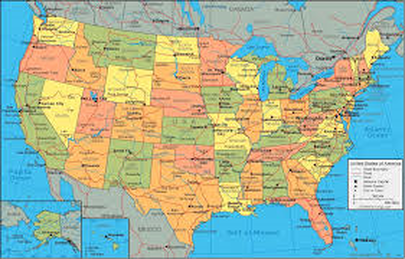
What is a Political Map?
A Political map shows a variety of different lines or colours to show all the different countries,states or even cities! They mainly focus on the national boundaries of a place. they have to use lots of colours so that the same colours are never side by side. capitol cities are usually indicated by a star