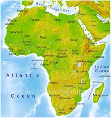
What is a physical map?
A Physical map shows the physical features of the specific country. For example they will show rivers mountains, lakes and much more. They show mountain elevation by colour! Usually, green shows lower and brown shows higher elevation. For example, this map of Africa has lots of mountains doesn't it?